The main benefit of a £15/ha VRN subscription isn’t just saving fertiliser; it’s forcing a financial discipline that can unlock hidden profitability by challenging core assumptions.
- The biggest savings often come from applying less nitrogen to your highest-yielding areas due to natural soil mineralisation.
- Free satellite data can deliver up to 80% of the benefit of paid services, provided you perform essential ground-truthing.
Recommendation: Prioritise GPS auto-steering as your first investment. Its ROI is the fastest and it is the foundational enabler for all subsequent precision tasks.
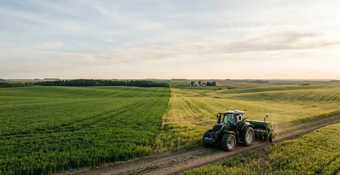
For any arable farmer with an eye on the bottom line, the rising cost of nitrogen fertiliser is a constant pressure point. Tech companies arrive with a tempting proposition: a subscription, perhaps £15 per hectare, for a variable rate application (VRA) system that promises to slash input waste. The marketing is slick, showcasing colourful field maps and promising optimised yields. It all sounds logical: apply more fertiliser where the crop needs it, and less where it doesn’t.
But let’s put on our farm accountant’s hat and look past the sales pitch. The real question isn’t whether technology can save fertiliser, but whether the net profit—after accounting for subscription fees, hardware depreciation, and your own valuable time—justifies the investment. The standard advice to “be more precise” is a platitude. What a farmer with tight margins needs is a rigorous cost-benefit analysis. Is this another expensive gadget or a genuine tool for financial resilience?
This analysis will dissect the business case for VRN from the ground up. We will challenge the fundamental assumption that high-yield areas always need more N. We will explore how to leverage free data before committing to paid services, evaluate the true cost of hardware, and expose the simple mistakes that can render the entire investment worthless. The goal is to replace marketing promises with a clear, numbers-focused framework to help you decide if this technology is a profitable asset or a costly liability for your specific operation.
To navigate this financial audit, we will break down the core components of a successful (and profitable) VRN strategy. This structured approach will move from foundational principles to practical implementation, helping you build a clear picture of the potential return on investment at every stage.
Summary: A Skeptical Farmer’s Guide to Variable Rate Nitrogen ROI
- Why High-Yielding Areas Often Need Less Nitrogen, Not More?
- How to Build a Nitrogen Plan Using Free Satellite Data in 3 Steps?
- Tractor-Mounted N-Sensor vs Drone: Which Offers Better ROI for 500 Acres?
- The Spreader Setting Mistake That Negates Variable Rate Precision
- How to Zone Fields by Soil Potential to Stop Wasting Fertilizer on Clay Caps?
- Why Conventional Nitrogen is Costing You £50 More Per Acre Than Nature-Based Alternatives?
- Why GPS Steering Has the Fastest ROI of Any AgTech Investment?
- Is AgTech Investment Viable for Arable Farms Under 300 Acres?
Why High-Yielding Areas Often Need Less Nitrogen, Not More?
The central, most counter-intuitive principle of profitable VRN is this: your most fertile, high-yielding ground often needs the least artificial nitrogen. Standard practice dictates that we “feed the yield,” pushing more inputs into areas that perform well. However, this ignores a critical factor in the profit equation: soil organic matter (SOM) and its mineralisation potential. High-yielding zones are often rich in SOM, which acts as a slow-release nitrogen reservoir. As the season progresses, microbial activity in this healthy soil mineralises organic nitrogen, making it available to the crop for free.
Applying a heavy dose of synthetic N on top of this natural supply is not just wasteful; it’s financially detrimental. The crop can only use so much nitrogen at once. Excess N is prone to leaching or denitrification, polluting the environment and your balance sheet. As veteran precision agronomists Kelly Garrett and Mike Evans discovered through extensive on-farm trials, this effect is significant. They note that the soil in high-yielding areas can be so active that it provides a substantial portion of the crop’s needs, a finding that completely inverts conventional thinking. As they put it:
Our soil in our high yielding areas is releasing so much Elemental nitrogen that we’re out running that carbon. That extra 45 pounds might go clear down to 80 pounds on high yielding ground.
– Kelly Garrett & Mike Evans, XtremeAg Variable Rate Nitrogen Podcast
This isn’t just an anecdote; it’s a fundamental shift in management. Instead of blindly chasing yield with inputs, VRN allows you to work *with* your soil’s natural fertility. The technology’s first job is to identify these highly productive, self-sufficient zones and pull back on applications. In fact, research from multi-year field trials demonstrates that VRN reduces application by 12-15% in these high-yielding zones, directly translating into input savings without sacrificing yield. This is the first and most crucial step in making the £15/ha subscription pay for itself.
How to Build a Nitrogen Plan Using Free Satellite Data in 3 Steps?
Before committing to a recurring subscription fee, a shrewd manager must first exhaust the low-cost alternatives. Fortunately, the European Space Agency’s Sentinel-2 satellites provide a wealth of high-quality, free-to-access data that can form the backbone of a “minimum viable” VRN plan. This approach requires more hands-on effort but offers an excellent way to understand field variability without initial financial outlay. The goal is to use NDVI (Normalised Difference Vegetation Index) imagery, which measures crop biomass and vigour, to create basic management zones. While not as precise as on-the-fly sensors, it’s a powerful first step.
The process transforms raw satellite pictures into a financially relevant action plan. It involves three key stages: acquiring and cleaning the data, validating it on the ground, and finally, creating a nitrogen prescription. It’s a method that turns a free resource into a tool that can significantly improve input efficiency. For instance, studies using Sentinel-2 data for variable rate nitrogen show an improvement in Nitrogen Use Efficiency (NUE) of up to 15%. This demonstrates that a DIY approach, when done correctly, can deliver tangible financial returns.
Here is a pragmatic, three-step plan to get started:
- Access and Baseline: Use platforms like the Copernicus Data Space or Google Earth Engine to access free Sentinel-2 imagery. The key is to filter out cloudy days (look for cloud cover below 20%) and then layer several images from the same growth stage over a 15-day window. This “stacking” process averages out temporary anomalies and creates a reliable baseline biomass map representing the true, stable variability in your field.
- Ground-Truthing: A satellite map is a hypothesis, not a fact. You must calibrate the digital zones with reality. This means taking targeted soil samples in your high, medium, and low vigour zones identified on the map. Alternatively, use a portable in-field NDVI sensor (like a Greenseeker) to take spot checks. This step is non-negotiable; it connects the colours on the screen to actual nutrient status and crop health in the soil.
- Rate Calibration: Finally, convert the NDVI values into a concrete nitrogen rate (kg/ha). The most robust way to do this is by establishing a nitrogen response curve on your own farm. In a few representative areas of your different NDVI zones, apply calibration strips with rates 25-30% above and below your standard farm rate. At harvest, measure the yield response. This data allows you to build a model that says, “for an NDVI value of X, the most profitable N rate is Y.”
This process is the definition of “return on management.” It requires time and attention to detail but builds a deep understanding of your fields that no off-the-shelf subscription can provide. It’s the perfect way to audit the potential of VRN on your farm before spending a single pound on software.
Tractor-Mounted N-Sensor vs Drone: Which Offers Better ROI for 500 Acres?
Once you’ve proven the concept with free data, the next logical question is about scaling up with dedicated hardware. This is where capital expenditure enters the P&L statement. Two dominant technologies emerge: real-time, tractor-mounted N-sensors (like Yara’s N-Sensor or Trimble’s GreenSeeker) and multispectral drones. From a farm accountant’s perspective, the choice isn’t about which technology is “cooler”; it’s about which delivers a better return on investment over its lifespan. We need to look at the Total Cost of Ownership (TCO).
A tractor-mounted sensor offers the benefit of “on-the-go” analysis and application in a single pass. It measures crop reflectance and adjusts the spreader rate in real-time, eliminating the need for separate data processing. A drone, on the other hand, is a data acquisition tool. It requires a separate flight to map the field, followed by data processing, before a prescription map can be created and loaded into the spreader’s controller. However, the drone offers versatility, capable of being used for weed mapping, stand counts, and thermal imaging. The following table provides a breakdown of the 5-year TCO for a hypothetical 500-acre operation, based on industry data.
| Cost Factor | Tractor-Mounted N-Sensor | Agricultural Drone (Multispectral) |
|---|---|---|
| Initial Equipment Cost | $8,000-$15,000 | $2,000-$10,000 |
| Annual Software/Calibration | $500-$1,500 | $500-$2,000 |
| Maintenance (5 years) | $2,000-$4,000 | $1,000-$2,500 |
| Data Processing Time | Real-time (minimal) | 2-4 hours per flight |
| Coverage Speed (500 acres) | During application (no extra time) | 2-3 flights (weather dependent) |
| Multi-use Capability | N-sensing only | N-sensing only |
| Total 5-Year Cost | $10,500-$22,500 | $5,500-$22,000 |
The numbers reveal a nuanced picture. While a drone can have a lower entry cost, the software fees and, crucially, the “hidden” cost of your time for data processing can make the TCO comparable to a tractor-mounted system. The decision hinges on your operational structure. For a larger operation where a dedicated operator can justify the time spent on data, a versatile drone might make sense. For a smaller or owner-operated farm where time is the most constrained resource, the “single-pass” efficiency of a tractor-mounted sensor, despite a potentially higher initial cost, might offer a faster and more straightforward path to ROI.
The Spreader Setting Mistake That Negates Variable Rate Precision
Investing thousands of pounds in VRN software and hardware is completely pointless if the final link in the chain—the fertiliser spreader—is not meticulously calibrated. This is the most common and costly “precision liability” in modern farming. A farmer can have perfect data and a perfect prescription map, but if the spreader isn’t physically delivering the correct rate to the correct place, the entire investment is wasted. It’s like using a surgeon’s scalpel with a blacksmith’s hammer. The lack of precision at this final stage doesn’t just reduce ROI; it eliminates it.
The scale of this problem is staggering. Application uniformity is measured by a Coefficient of Variation (CV), where a lower number is better (a CV below 15% is considered good). Field trials measuring application uniformity revealed that a well-calibrated spreader can achieve a CV of 12.5%, while an uncalibrated one can easily reach 49.5%. At that level of inaccuracy, your “variable rate” is pure fiction; you are simply applying fertiliser randomly, creating massive over- and under-application zones that decimate yield potential and profitability. This isn’t a minor tweak; it’s the difference between precision agriculture and precision chaos.
Ensuring your spreader is truly “VRN-ready” goes beyond a simple tray test at a single rate. It requires a specific set of calibrations designed to handle the dynamic changes demanded by a prescription map. Ignoring these steps turns your high-tech asset into a high-cost liability.
Your VRN-Ready Spreader Audit Checklist
- Actuator Lag Compensation: Check if your rate controller is configured with a 2-5 second “look-ahead” distance. This accounts for the physical delay between the computer sending a rate change command and the actuator actually adjusting the gate, ensuring fertiliser rates change *before* you cross a zone boundary, not after.
- Multi-Rate CV Testing: Conduct static tray tests not just at your standard rate, but at the minimum and maximum rates in your prescription. Your CV must remain below 15% across this entire range. If the spread pattern collapses at low rates, your VRN plan is not viable with that setup.
- Bout Overlap Settings: Verify your GPS settings. Is the offset measured to the GPS antenna or the spreader disc’s centerline? More importantly, is section control overlap compensation enabled? This prevents double-dosing at the angled edges of management zones, a common source of lodging and wasted N.
How to Zone Fields by Soil Potential to Stop Wasting Fertilizer on Clay Caps?
A simple NDVI map from a single satellite image only tells you how the crop is performing *now*. A profitable VRN strategy, however, must be built on the field’s stable, underlying potential. The goal is to create robust management zones that reflect inherent soil properties, not just the fluctuations of a single season. This is crucial for dealing with persistent problem areas like sandy patches that can’t hold nutrients or heavy clay caps that become waterlogged and limit root development. Pouring expensive fertiliser onto these low-potential areas is like trying to fill a leaky bucket—a complete waste of money.
Creating these foundational zones requires a multi-layered data approach. Think of it as a digital soil survey, where each layer of information adds more detail and refines the boundaries of your management zones. Relying on a single data source, like one year’s yield map, is a common mistake. A drought year might make sandy soil look like your worst-performing area, while a wet year might make it look average. True potential is only revealed by combining multiple years and multiple data types to find the patterns that hold true regardless of the weather.
The most robust method involves integrating historical performance, topography, and direct soil measurement. This creates a definitive map of your soil’s productive capability, allowing you to allocate inputs for maximum economic return, not just maximum yield. Here is a proven, multi-layer process:
- Layer 1 – Historical Yield Data: The foundation of any good zoning system. Merge 3-5 years of clean yield monitor data. This will smooth out season-specific anomalies and reveal the areas that are consistently high, medium, or low yielding. These are your initial, broad management zones.
- Layer 2 – Topographic Analysis: Overlay elevation data. A simple digital elevation model (DEM) can highlight hills, slopes, and low-lying depressions. This context is critical. It helps explain *why* a yield zone exists. For example, a low-yielding zone might perfectly correlate with a steep slope prone to erosion or a clay cap depression that suffers from waterlogging.
- Layer 3 – Electrical Conductivity (EC) Scanning: This is the soil texture layer. An EC map, created with tractor-mounted sensors or by a contractor, measures how well the soil conducts electricity. This is directly related to soil properties like clay content, water-holding capacity, and salinity. High EC values typically indicate heavier clay soils, while low EC points to sandier soils. Overlaying this on your yield and topography maps provides the definitive “ground truth.”
- Validation Step: Once your zones are defined by these three layers, perform targeted soil sampling. The most valuable samples are not from the middle of a zone, but from the transition areas *between* zones. This confirms that the digital boundaries you’ve drawn correspond to real, measurable differences in soil texture, organic matter, and nutrient levels.
This layered approach creates a durable, reliable map of your farm’s production engine. It’s the blueprint upon which all future profitable precision decisions are built.
Why Conventional Nitrogen is Costing You £50 More Per Acre Than Nature-Based Alternatives?
Sticking with a conventional, flat-rate nitrogen application isn’t a financially neutral decision; from an accountant’s perspective, it’s an active liability. The unvarnished truth is that a significant portion of every bag of fertiliser is wasted. The system is inherently inefficient. When nitrogen is applied in a single, large dose, the plant is unable to absorb it all. The rest is lost to the environment through leaching or volatilisation, representing a direct financial loss and an environmental cost.
The numbers are stark. On a global scale, the problem is well-documented and consistent across different cropping systems. As a general rule, crops are only able to take up and use a fraction of the nitrogen that is applied to them. This inefficiency is the baseline “cost of inaction” that a flat-rate system incurs every year. Specifically, global agricultural studies consistently show that crops utilize only about 50% of applied nitrogen effectively. This means for every £100 spent on N, £50 is effectively lost before it ever contributes to yield.
The £50/acre figure in the title isn’t hyperbole; it’s a conservative estimate of this inefficiency cost combined with the missed opportunity of optimising applications. Variable Rate Application (VRA) technologies, by matching application to crop need and soil potential, directly attack this waste. By spoon-feeding the crop what it needs, when it needs it, and where it can use it, VRA fundamentally improves Nitrogen Use Efficiency (NUE). Instead of a single large, wasteful application, VRA implements a more dynamic approach that mirrors the natural uptake rhythm of the crop.
This isn’t just about saving a few kilograms of N here and there. It’s about shifting the entire financial model of fertility. It’s the difference between treating fertiliser as a blunt instrument and treating it as a precision tool. The potential upside is a dual benefit: reduced expenditure on inputs and, in many cases, increased overall yield by eliminating under-fertilised areas. This combined effect makes the “do nothing” option a demonstrably expensive strategy in the long run.
Why GPS Steering Has the Fastest ROI of Any AgTech Investment?
In the complex world of agricultural technology, where promises of ROI are often murky, one investment stands out for its rapid, tangible, and easily quantifiable return: GPS auto-steering. From a purely financial standpoint, before even considering variable rate fertiliser, auto-steer is the foundational investment that unlocks the profitability of all other precision tasks. It is the gateway technology for profitable precision farming. While VRN can take a season or two to fine-tune and show a clear return, auto-steer starts paying for itself from the first hour of operation.
The primary return comes from the drastic reduction of overlaps and skips during field operations like seeding, spraying, and fertilising. A human operator, even a highly skilled one, will naturally have an overlap of 5-10%. An auto-steer system can reduce this to less than 2%. On a large scale, this translates into immediate and significant savings on seed, chemical, and fertiliser costs, not to mention fuel and operator hours. The cost of entry for these systems is also more accessible than ever before. Furthermore, the reduction in operator fatigue allows for longer, more efficient workdays during critical planting and spraying windows, which has its own significant economic value.
The team at Farmonaut, in their analysis of precision ag costs, summarises this unique position perfectly. It’s not just about the direct savings; it’s about creating the platform for future gains.
GPS guidance systems deliver immediate savings through overlap reduction and less fuel/labor, making them the foundational enabler that unlocks ROI of all subsequent precision farming investments including VRN, mechanical weeding, and band spraying.
– Farmonaut Research Team, Precision Agriculture Cost & ROI Analysis 2025
Without the repeatable, sub-inch accuracy provided by GPS guidance, creating and executing accurate management zones for VRN is nearly impossible. Attempting to manually steer along VRN zone boundaries is impractical and negates the precision you’ve paid for. Therefore, in a stacked-ranking of AgTech investments, GPS auto-steering has the fastest and most certain payback period, making it the non-negotiable first step on the path to a fully optimised precision farming system.
Key Takeaways
- The highest return on VRN often comes from reducing nitrogen on your most fertile ground, not increasing it.
- Inaccurate spreader calibration is the single biggest factor that can destroy the ROI of any VRN investment.
- GPS auto-steering is the foundational AgTech investment; it has the fastest payback and enables all other precision tasks.
Is AgTech Investment Viable for Arable Farms Under 300 Acres?
This is the critical question for the majority of farmers. The benefits of precision agriculture are often demonstrated on vast, 1,000+ acre operations, but does the financial model hold up on a smaller, more typical arable farm? The initial data can be discouraging. High capital costs for equipment like VRA-ready spreaders and sensors are harder to amortise over fewer acres, making the break-even point seem impossibly distant. The statistics bear this out, showing a clear disparity in adoption rates between large and small operations.
For example, evidence points to a significant gap in the uptake of these technologies based on farm size. This is not due to a lack of interest, but a cold, hard calculation of risk and return. In one analysis, the 2023 USDA precision agriculture survey found that VRA adoption was only 5% on small farms compared to 45% on large farms. The economic reality is that the per-acre cost of technology is simply higher for smaller operations, pushing the payback period further into the future. Some academic models even suggest a high acreage threshold for VRA to be economically viable under current input and technology costs.
However, this doesn’t mean precision ag is a “no-go” for farms under 300 acres. It simply means the strategy must be different. Instead of a large, one-time capital outlay, the approach must be incremental, modular, and focused on “low-hanging fruit.” It’s about a “tech-stacking” strategy, where each layer of investment is low-cost, has a rapid payback, and builds the foundation for the next. This requires more management but de-risks the investment journey significantly.
Here is a pragmatic, step-by-step tech-stacking strategy for a small- to medium-sized farm:
- Year 1 Priority: GPS Auto-Steering. As established, this is the starting point. An investment of £5,000-£10,000 immediately reduces overlap, saving 5-10% on all inputs (seed, spray, fertiliser) and fuel. The payback is typically within one to two seasons, providing the capital and confidence for the next step.
- Year 2 Addition: Low-Cost Crop Monitoring. Adopt a satellite-based crop monitoring service. For a modest annual subscription (£500-£2,000), you gain access to NDVI and other vegetation maps. This allows you to start identifying field variability and scouting problem areas efficiently without any further hardware investment.
- Year 3 Expansion: Yield Mapping. The next logical step is to start gathering your own historical data. This can be done by adding yield mapping capability to your combine monitor or, more cost-effectively, by hiring a contractor for harvest who can provide you with the data. This builds the critical historical data layer for future VRA decisions.
- Alternative Path: Co-operative Investment. For high-cost, low-usage equipment like soil EC mappers, multispectral drones, or a VRA-capable spreader, forming a small co-operative with neighbouring farms is a highly effective strategy. This distributes a £20,000+ equipment cost across multiple operations, making it financially viable for everyone.
This phased approach transforms precision ag from a daunting capital expense into a manageable, year-on-year operational improvement plan.
Ultimately, the decision to invest in a £15/ha VRN subscription is not a simple yes or no. It’s a management decision that requires a thorough audit of your current operation, a commitment to meticulous calibration, and a clear-eyed view of the numbers. To determine if this is the right step for your specific business, the next logical action is to conduct a simple, field-level profitability audit based on the principles outlined here.